
The Incrementor Tool is especially helpful when you identify a consistent numerical error across multiple data points.
For example, if there is a group of tree addresses are all off by two, you can select those trees and increment the address field by two rather than opening and updating each tree individually.
Step 1.) Create a Data Point Selection
• Create a selection of the data points you would like to increment:
• Make sure all of the data points requiring the same adjustment are included in your selection before continuing.
ArborPro Tip: You can perform a mass selection by using the Selection Tool in your Map Tools Bar. Your Tree Dashboard count will update to reflect the number of points selected versus the number of total Active Points within the software.
Arborist Tip: Always double-check your selection and increment amount before applying the update, since the change will be applied to all selected datapoints.
Step 2.) Open the Incrementor Tool
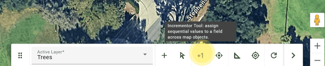
• Open the Incrementor Tool, represented by the (+1) icon in your Data Analysis toolbar.
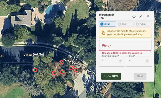
Step 3.) Select your Field from the Setup Tab
• Choose the Field you want to adjust. Some examples include:
- Address numbers
- Site numbers
- Tree tags
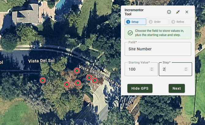
Step 4.) Enter the Increment Amount in your Setup Tab:
• Enter your Starting Value from its field.
• Enter the Step in its field. This amount you want to add or subtract from the existing Starting values.
- A positive increment increases the value.
- A negative increment decreases the value.
ArborPro Tip: The Incrementor Tool will adjust each existing value by the amount you entered.For example, if you apply an increment of 2:
100 to 102
101 to 103
102 to 104
• Click the green "Next button to continue to your Order Tab.
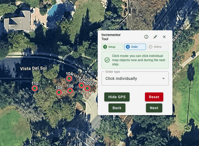
Step 5.) Order your Increment
•Select your Order Type:
Click Individually: Allows you to manually select the data points you want to increment by clicking them individually.
Anchor Point: Allows you to designate a starting point for your increment. Data Points closer to the Anchor Point will have a greater value.
Line: Allows you to draw a straight line across the map to determine the order in which the selected data points are incremented. Data points along the line are assigned values based on their position relative to the line.
Polyline: Allows you to create a series of connected lines to define a more specific path across the map. This is useful when the data points follow a curved, irregular, or non-linear route.
• If applicable, proceed to select your Boundary or Region Type and create your boundary or Region where to populate your Increment Values.
• Click the green "Next" button to continue to your Refine Tab.
Step 6.) Refine Your Increment
• Before continuing, review the refined selection to make sure it contains only the data points you want to update. You can remove a data point by clicking on it from your Map View.
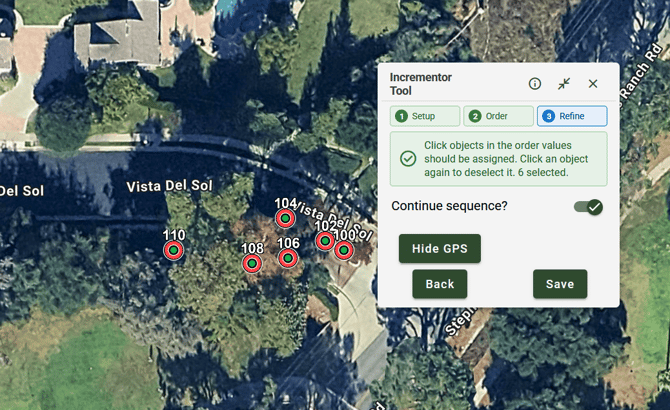
Step 7.) Apply Your Increment
• Click the green Save" button to apply the update to your selected data points
ArborPro Tip: Having the "Continue Sequence" toggle on will remember your last number increment value and carry over to your next sequence.